Sedimentary
rocks of Jurassic, Cretaceous and Tertiary age are marvelously exposed in
the Isle of Purbeck area.
The oldest rocks found locally are those of the Kimmeridge Clay Formation,
which include bituminous oil shales, and whose outcrop stretches
north-eastwards and into the North Sea, where it is the principal source
rock for North Sea oil. Overlying the Kimmeridge Beds are the easily worked and much exploited
sands and limestones of the Portland Group, followed upwards by rapid
alternations of limestones and clays in the Purbeck Beds. Soft clays
make up much of the succeeding Wealden Formation.
Throughout the Jurassic and early Cretaceous, a fault, the Purbeck Fault
was active in the area and controlled the thicknesses of the above rock
formations. This fault also had a significant part to play in the
preservation of oil in the Purbeck district, by acting as a route along
which oil was able to migrate upwards and into sandy reservoir rock layers
where it accumulated. Oil is recovered using "nodding donkey" wells,
of which there is one at Kimmeridge Bay and a group at Wytch Farm.
Movement along the Purbeck Fault ceased before marine deposition of the
glauconitic sands of the Upper Greensand Formation, which overstep the
earlier formations and are followed upwards by the marine coccolithic pure
limestone of the Chalk. Chert nodules are a common feature in the
latter and represent accumulations of silica ultimately derived from
sponge fossils. Above the Chalk, the unconformable contact of the succeeding continental
Reading Beds, the first representative of the Tertiary era, is clearly
seen in the area. They are seen to contain pebbles eroded from the
Chalk. |
The rocks of the Purbeck area, as well as those in much of southern
England, were subjected to folding in mid-Tertiary (Miocene) times.
This may have been a distant effect of the Alpine orogeny, but it
may also have been related to movements to the west of the British Isles,
associated with the rifting apart of the North Atlantic Ocean.
In any event, the result was that a monoclinal fold was created in the
Purbeck district, with many beds, notably the Chalk, being tilted to a
near vertical position, with a gentle syncline occupied
by Tertiary strata to the north, and a gentle anticline extending out to
sea in the south.
THE
SHAPE OF THE LAND TODAY
The effect of the varying resistance to erosion of different rock strata
is beautifully displayed in the landscape of Dorset as we see it
today. The hogsback chalk ridge of the Purbeck Hills stretches from
west to east, coming to an end in the dramatic headland of Old Harry
Rocks, while the Purbeck beds reach the coast at the headland south of
Swanage.
The softer rocks amongst these headlands have been carved out to form
bays, Swanage Bay in rocks of the Wealden Formation, and Studland Bay in
the largely unconsolidated Tertiary beds of the Hampshire Basin.
Further to the west, the Purbeck beds form the dramatic feature of the
Lulworth Crumple. Here, a hard coastal strip of Portland limestone
for long resisted marine erosion, but once breached, the sea has been able
easily to carve its way inland through the alternating layers of the Purbeck beds to form Stair Hole. Just to the east, the sea has
penetrated further, through the soft clays of the Wealden Formation, to
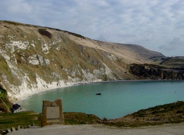
form the famous Lulworth Cove.
|
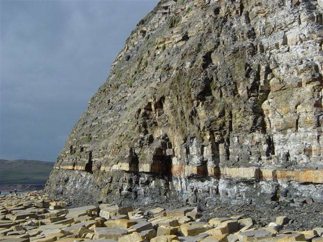 |
Kimmeridge Clay, with dark bituminous layers and oil shales. |
|
|
|
|
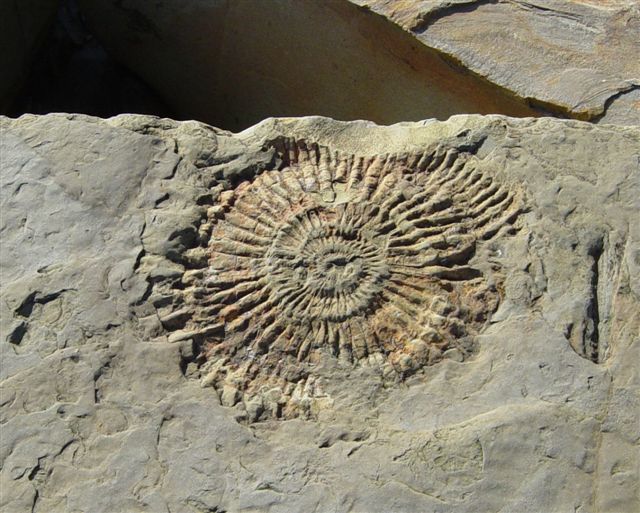 |
Ammonite fossil from the Kimmeridge Beds - Titanites.
(about
1 foot in diameter) |
|
|
|
|
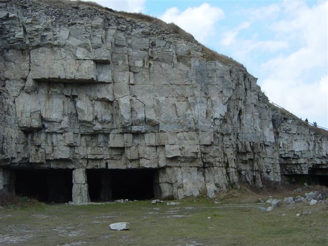 |
White Portland limestone at Winspit on St. Albans head - which was excavated using stall and pillar quarrying. |
|
|
|
|
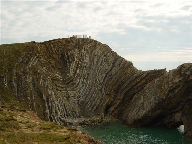 |
Lulworth Crumple and Stair Hole. Erosion resistant Portland
Beds at right, less resistant Purbeck Beds at left. |
|
|
|
|
 |
Lulworth Cove. Eroded out of soft rocks of the Wealden Formation, with Chalk further inland, on the left. |
|
|
|
|
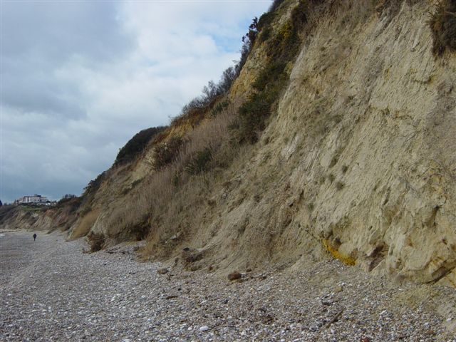 |
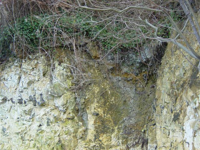
Soft clays of the Wealden Formation, north of Swanage. |
|
|
|
|
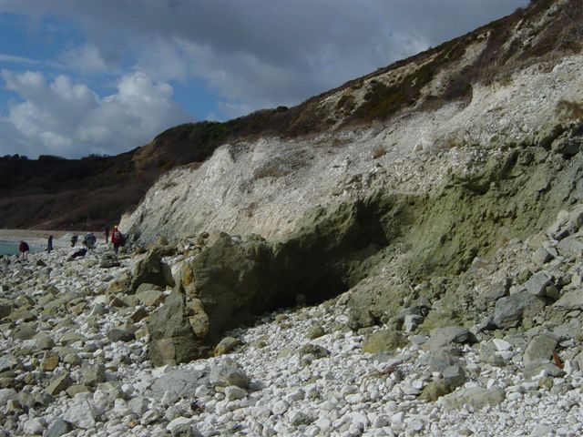 |
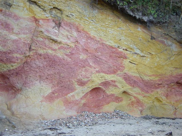
Gault (left), overlain by Upper Greensand (rich in glauconite), north of Swanage |
|
|
|
|
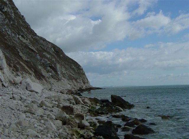 |
Upper Cretaceous
Chalk, north of Swanage. |
|
|
|
|
 |
Reading Beds, top, (with chalk pebbles),of Tertiary age, unconformably overlying Chalk with chert nodules. Studland Bay. |
|
|
|
|
 |
Poole Formation - Tertiary unconsolidated sands. Studland Bay. |
|
TOP |
NEXT FIELD TRIP > |
|
|
|
|
|
|
|