| 23rd April 2006 | ||||||||||||||||||||||||||||||||||||||||||
| DOBB'S LINN | ||||||||||||||||||||||||||||||||||||||||||
| Tour: OUGS (east Scotland) Participants: 15 | ||||||||||||||||||||||||||||||||||||||||||
| Weather: sunny, pleasant | ||||||||||||||||||||||||||||||||||||||||||
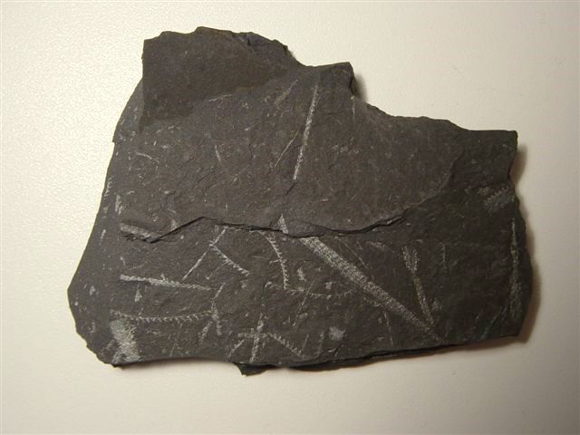
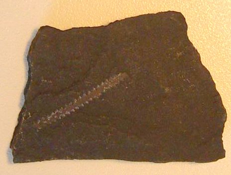
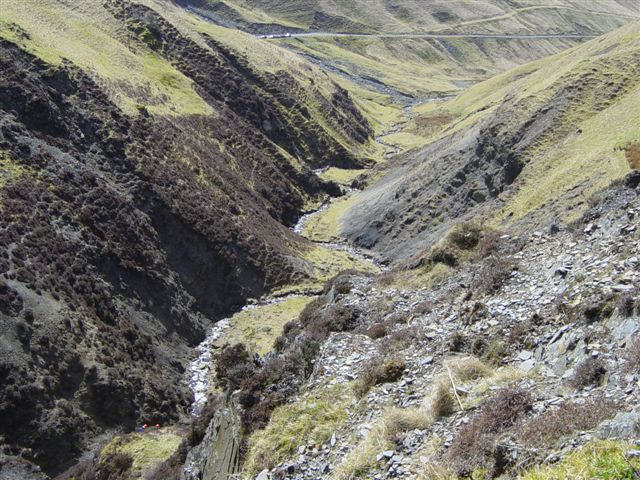
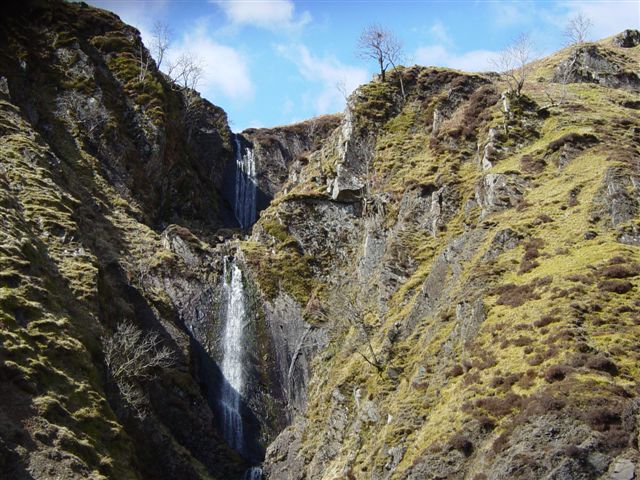
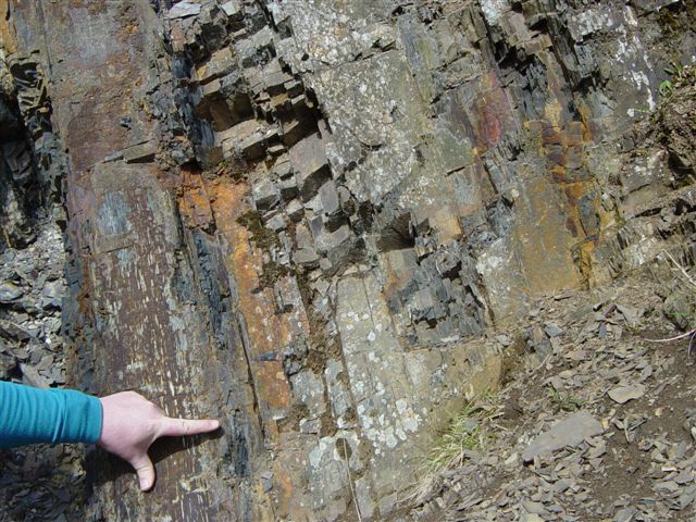
Summary of Geology: Dob's Linn is situated on the Moffat to Selkirk road, a little north of the Grey Mare's Tail waterfall visitor centre. It is a classic geological site. The Southern Uplands is predominantly made up of a rather monotonous sequence of greywackes, formed during early Palaeozoic times when turbidity currents carried sediments rapidly down the sides of the continental shelf separating the northern and southern parts of the future British Isles, while they were still separated by an ocean - the Iapetus Ocean. Occasionally, conditions settled and muds slowly gathered in the deeper waters further from the continental margin. As the Iapetus Ocean started to close in Ordovician times, successive underthrusting of sediments accumulating on the floor of the ocean created an accretionary prism in which the individual sedimentary units young upwards as normal, but the overall younging is downwards, that is towards the south-east. When collision between the northern continent which would form the British Isles (Laurentia) and the southern continent (Avalonia) finally occurred in Silurian times, the accretionary prism was thrown up above sea level to form part of the Caledonian mountain system. The occasional muds are now converted to shales, collectively referred to as the Moffat Shales. Their particular interest lies in their abundant graptolite fauna, which has allowed very accurate dating of the shales. Graptolites Graptolites are a group of extinct, visually rather unexciting fossils, resembling pencil marks on the surface of the rock looking like fretsaw blades, but they are of great value as zone fossils - allowing the accurate relative dating of rocks - due to their widespread distribution and rapid evolution. They consisted of colonies of one or more stems (stipes) which bore little cups (thecae) of various different shapes. The thecae housed the individual animals. They were marine planktonic animals (hence their widespread distribution), which fell on death to the bottom of the sea floor, which, for their preservation, must have lacked oxygen and any deep sea predators. Evolutionary trends in the graptolites were towards a reduction in the number of stipes, and Silurian times are characterized by the Monograptids, which have one stipe and thecae on only one side of it (i.e. uniserial). Biserial types are found at all levels. The famous geologist Charles Lapworth studied the graptolites at Dob's Linn in the 1870's and was able to establish the essentials of the geological structure of the area using them. In 1985, Dob's Linn was chosen as the site of the world stratotype boundary for the Ordovician/Silurian systems, thanks to its abundance of fossils. That boundary can be seen below the waterfall in the Linn Branch.
|
||||||||||||||||||||||||||||||||||||||||||