Summary of Geology: (see also the report on my trip to
Raasay in May 2006).
The oldest rocks of the region are the Lewisian gneisses, which were formed by metamorphism of even older,
mostly
igneous rocks by continental collisions in the early days of Earth's
history. They are typically hard pink and white banded gneisses,
sometimes interrupted by thick darker basaltic areas.
Overlying the Lewisian are Torridonian sandstones and
conglomerates - a thick sequence of virtually unmetamorphosed
sedimentary rocks, formed by fluviatile erosion of remoter Lewisian
areas and laid down on a buried landscape of hills and valleys carved
out of
the Lewisian.
The Torridonian was tilted to the west, then eroded to a horizontal surface before being invaded by shallow seas
at around 500 Ma, in the Cambrian. Pure sands were laid down, now
converted with the passage of time to an orthoquartzite - an
unmetamorphosed quartzite in which the original sand grains, cemented
now by silica, can be clearly seen. This is the Eriboll Quartzite.
Later, and extending into Ordovician times, as the sea deepened, limestones were laid down and are seen today as the Durness Limestone.
These Cambro-Ordovician rocks contain trilobite fossils (e.g. Olenellus) quite different from those of
England and Wales, which at this time were on the margins of Avalonia,
up to 1500 miles away on the other side of the Iapetus Ocean!
The whole sequence was then tilted back to the east, thereby returning the Torridonian sediments to an approximately horizontal position.The Lewisian, Torridonian and Cambro-Ordovician units were essentially left unscathed by the Caledonian Orogeny and are together referred to as the Foreland.
Much later, at around 430 Ma, as part
of the Caledonian Orogeny, arising from the collision of Laurentia with
Avalonia, or Baltica, vast amounts of deep sediments were squeezed, metamorphosed, and thrown over the younger Cambrian and Ordovician units to the west as
great overthrusts or nappes, of which the Moine Thrust is the best known. Often, in fact, the Cambro-Ordovician units provided the slide
planes on which movement took place. In north-western parts of
Scotland, these overthrust rocks are generally the Moine schists, but in
Skye, even deeper
rocks of the Lewisian basement from east of the thrust were thrown over to
the west.
Following the Caledonian Orogeny, a
vast amount of time through the Devonian, Carboniferous and Permian
periods is unrepresented on Skye and Raasay. This is because
these were predominantly periods of erosion in this region.
We take up the story again in the Triassic, when bright red sandstones and conglomerates were laid down in
an arid climate and are exposed today in parts of Raasay. We can
distinguish these rocks from the Torridonian because the Triassic beds
are less hardened and because they contain pebbles eroded from the
underlying Cambro-Ordovician limestones (identified by their reaction
with acid).
Rocks of Jurassic age are extensively
exposed throughout the the region. Warm shallow tropical seas laid
down shales, sandstones and limestones. The limestones are often
oolitic and locally are rich in chamositic iron, as on Raasay, where
they were worked for a short time at the end of the First World War. Deeper Cretaceous seas then covered the
region, and indeed all but the highest mountains of Scotland.
The early Tertiary is represented on
Skye by extensive sheets of basaltic lava flows, a tiny eroded outlier
of which caps Dun Caan on Raasay. These lava flows protected the
underlying Mesozoic rocks from erosion - for example, a fragment of
Cretaceous rock can be found below the basaltic cap of Dun Caan, and
provides the evidence for the former extensive cover of chalk. Sills
and dykes are common in north-east Skye and a notable sill, the
granophyre sill, covers a large area of southern Raasay.
A little later in the Tertiary, huge volcanoes formed on Skye, the
eroded roots of which are exposed today as the granite of the Red Hills
and the gabbro of the Cuillins.
Late Tertiary erosion has exposed these coarse-grained, deep-seated rocks at the surface and has carried the vast bulk of the Mesozoic deposits into marine basins which surround the area.
This erosion continued into the Quaternary of the last two million years, whose glaciation shaped the landscape as we see it today.
|
| |
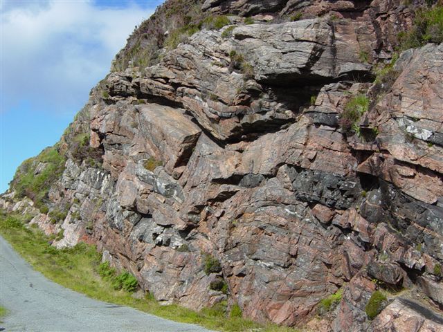 |
Typical Lewisian gneiss, seen here
in a roadside cutting in north Raasay. Finely banded gneiss with
dark layers rich in biotite and hornblende and lighter layers rich
in quartz and feldspar. The larger scale horizons of dark rock
are basaltic and have stretched and split - this is boudinage. |
| |
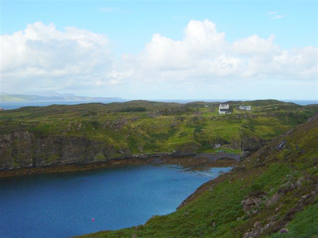 |
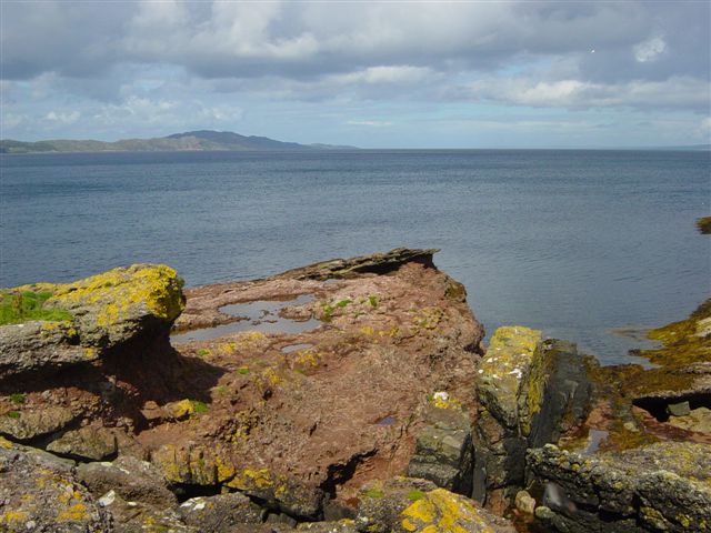
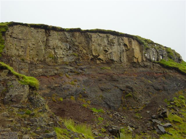
The island of Fladday, in the
background, is built on gently dipping Torridonian Sandstone. On
"mainland" Raasay, in the foreground, the Torridonian has turned to
dip steeply seawards (see detail in the photograph below).
Thus, these beds were formed by erosion of the underlying Lewisian,
which forms higher ground just off to the right. |
| |
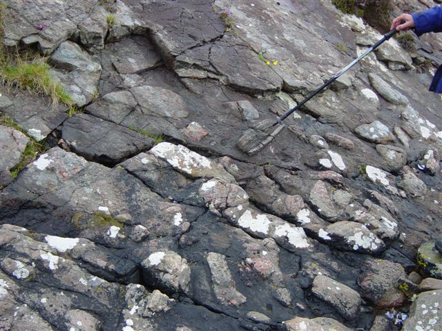 |
Steeply dipping Torridonian conglomerate, as described above. These conglomerates cannot
contain limestone (those of the Cambro-Ordovician are younger), but
they do contain clasts of the underlying Lewisian (as the geologist
is indicating). |
| |
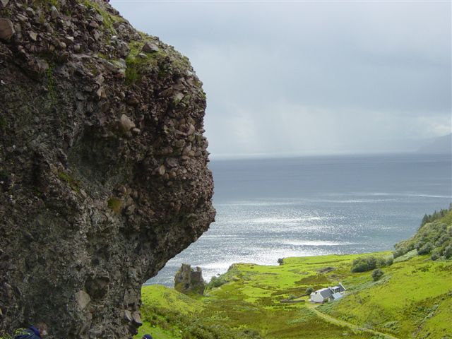 |
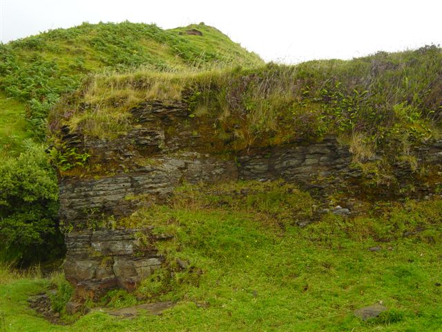
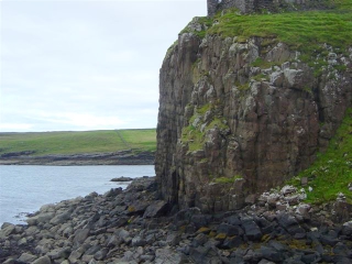
The origin of these Torridonian conglomerates in eastern Raasay is uncertain.
They form the high ground in the foreground and close to Brochel
Castle in the background. They may have been pushed up as gas vents
in the Tertiary, but in that event, they would be expected to
contain only angular clasts. In fact, clasts are often
rounded, and a crude sedimentary layering can be seen. |
| |
 |
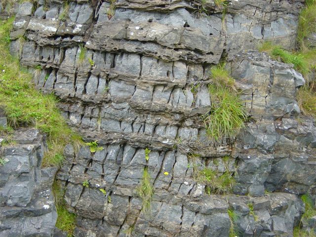
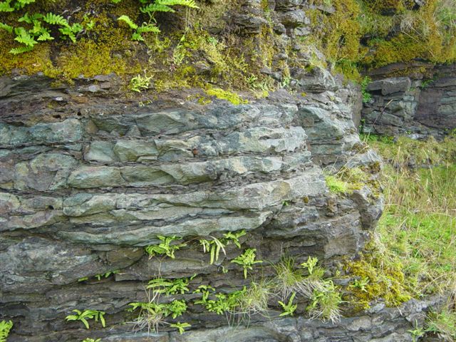
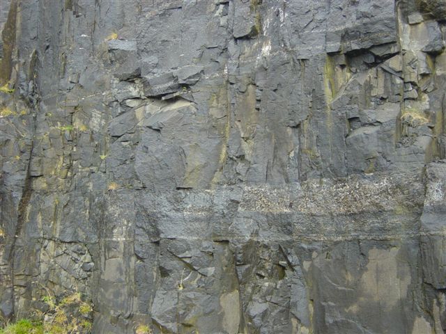
The Moine Thrust, as seen in most
of the North-West Highlands, carried deeply folded Moine Schists
over the unmoved Foreland, but here, in southern Skye, it carried
deeper Lewisian rocks (top) over Torridonian sandstones (the dark
rocks at bottom of picture). The Lewisian is much altered.
Over a zone of about one metre above the contact, rocks are
stretched and sheared by the thrusting to form a mylonite. (Allt Duisdale, Sleat Peninsula.) |
| |
 |
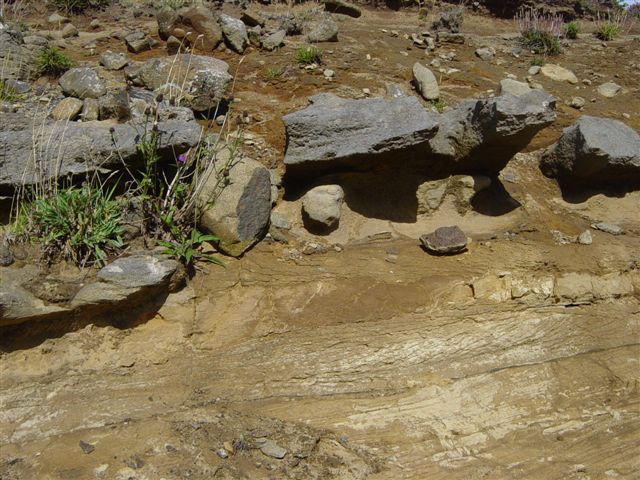
Triassic sandstones and
conglomerates at Rubha na' Leac, eastern Raasay. Clasts
contain limestones of older cambro-ordovician age. A Tertiary
dyke, later faulted, can be seen cutting the beds. Close
examination also reveals light green gypsum veins. |
| |
 |
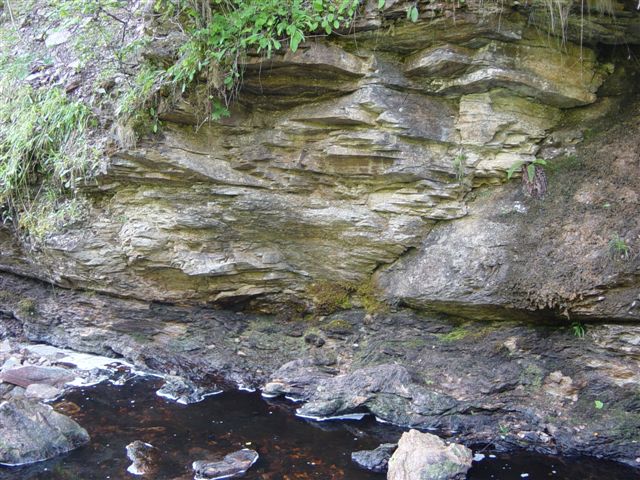
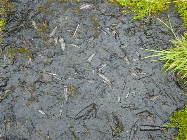
A typical exposure of alternating
shales and limestones from the Lias (Lower Jurassic) of Raasay.
Abundant oysters (Gryphaea) can be seen, mostly but not exclusively
in the shale bands. Recent erosion by acid rains is hollowing out
the limestone. (close
to former ironstone railway, near the ferry terminal). |
| |
 |
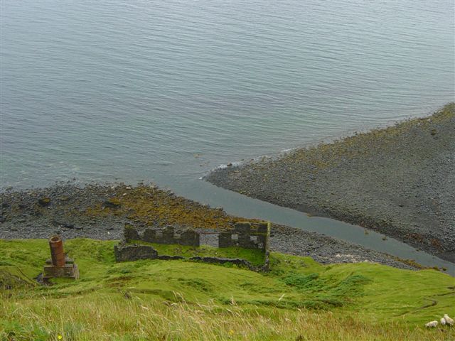
The opencast Lower Jurassic ironstone workings, as left abandoned in about 1920. Behind it can
be seen topsoil taken off the top of the ironstone beds in
preparation for working, which never, in fact, took place.
Beds rich in iron (up to about 15% Fe) are those with a deep brown colour. (on hillside to the right of the mine ventilation fan building, north of road to Hallaig). |
| |
 |
This exposure is a few
yards to the left of that in the picture above. It shows
belemnites - the surviving hard parts of squid like creatures which
abounded in Jurassic seas, and which sank and accumulated on the
sea bottom on death. The absence of benthos (bottom-living
creatures like bivalves and brachiopods), suggests stagnant
conditions). |
| |
 |
A detail of the Raasay ironstone beds (Lower Jurassic), as shown above. This is a condensed sequence,
which means that sedimentation was continuous, but less thick than
equivalent rock units elsewhere. |
| |
 |
Middle Jurassic Valtos Sandstone, south of Staffin, north Skye. They are
generally white/brown, but contain concretionary darker layers.
Note the distinct cross-bedding in one layer. (roadside cutting south of Staffin). |
| |
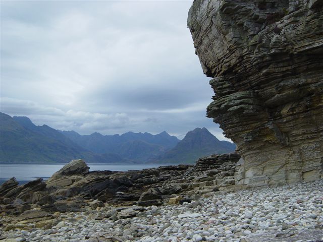 |
Middle Jurassic sandstones at Elgol in southern Skye, with a magnificent backcloth
of Tertiary Cuillins. The sandstones erode to form a typical
honeycombed appearance. |
| |
 |
The layered Tertiary gabbro intrusion below Duntulm Castle at the north end of Skye.
About 15 layers can be detected here, each formed as heavy minerals
settled to the bottom of the layer during cooling. |
| |
 |
Red bole weathering in Tertiary basalt lava flows. Rapid weathering of a lower lava
layer, barely visible, in the hot humid climate of the times has
resulted in the formation of a fossil lateritic soil, rich in
iron, before deposition of the lava flow on top.
(The Quiraing, north Skye). |
| |
 |
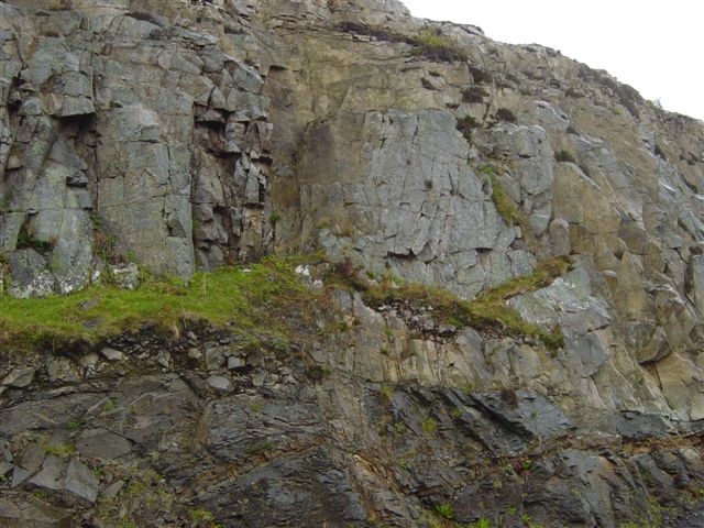
Coarse grained gabbro,
showing up as persistent white layers within a Tertiary basalt sill
intruding the Jurassic of eastern Skye.
(quarry at Lealt). |
| |
 |
The Red Hills of Skye, a
coarse-grained granite intrusion of Tertiary age, exposed today as a result of
erosion of overlying sedimentary material. The "red" colour is
due to presence of pinkish orthoclase feldspar. Glaciation of
the granite results in very well rounded hills. |
| |
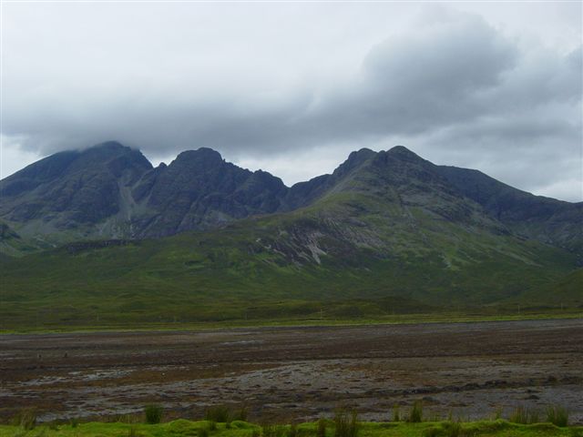 |
The Black Cuillin Hills
of Skye, a coarse grained basic intrusion of Tertiary age, exposed
today as a result of erosion of overlying sedimentary material. Glaciation of easily eroded gabbro results in hills with a jagged
outline. |
| |
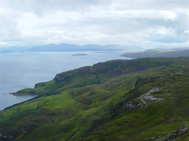 |
The view south-eastwards
from the Tertiary basaltic summit of Dun Caan on Raasay. The
nearer promontory is Rubha na' Leac, with its Triassic beds,
overlain at bottom left by landslipped Jurassic. A sliver of Cretaceous rock is known to exist below the lava flow on top of Dun Caan, and may be the light patch towards bottom right. (see photo in Raasay, May 2006 report). |
| |
 |
Late in Quaternary times, following the Ice Age, conditions were right in places for
the formation of diatomaceous earth (Kieselguhr), a recent deposit formed when
minute diatoms in lakes use fine silica to build their shells. This
long abandoned plant at Lealt used diatoms from nearby Loch Cuithir.
Kieselguhr mixed with nitroglycerine was used to produce dynamite at
Ardeer Factory in Ayrshire.
|
| |
 |
A large area of southern Raasay is
occupied by a Tertiary granophyre sill. Here, the sill is
at top, with predominantly Jurassic rocks below. The latter
are cut by a later Tertiary dyke, which does not penetrate the
sill but appears to turn and to run below it on the right. The
dyke is in turn cut by a thin brown semi-horizontal intrusion. (roadside exposure between ferry
terminal and Inverarish). |
| |
TOP |
NEXT FIELD TRIP > |
|