| Key Points |
| |
- A
medium-grained dolerite sill, intruding sandstones and cementstones
of Carboniferous age.
|
- Tilted to the west by
earth movements.
|
- Quaternary ice sheets stripped off the top cover of sediments and
rode easily, from west to east, over the gentle westerly-dipping
dolerite dip slope, moulding the top surface into glaciated
pavements. To the east, steeper slopes hide the sedimentary
formations below.
|
- The
direction of ice movement on Corstorphine Hill might be inferred as either west to east or east to west by the presence of scratch marks
on some of the glaciated pavement surfaces and by the carving of
weaker layers in the dolerite in the direction of ice movement. However, the presence of roches moutonnées proves that movement was,
in fact, from west to east. In these, the smoothed,
streamlined surface indicates the up-glacier surface, while the
broken, plucked out side is the lee-side.
|
|
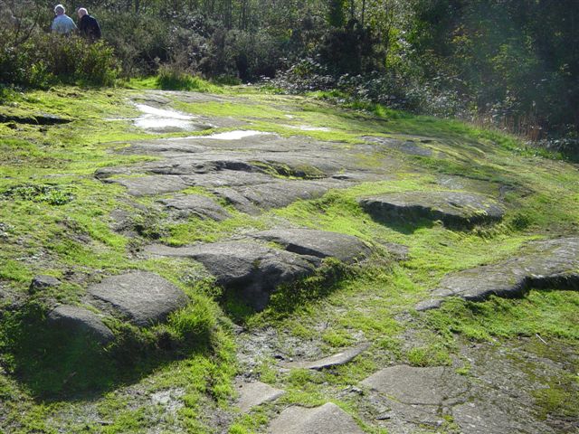 |
A roche moutonnée - the
direction of ice movement was from west to east, upslope, on the gentle western slope
of the hill, i.e. from top left in the photograph (smoothed
surface), towards the bottom right (plucked out). |
|
TOP |
NEXT FIELD TRIP > |
|