Summary of
Geology:
The
succession of Carboniferous rocks between Bathgate and
Linlithgow includes thick limestones and lava flows, up to 500
metres thick, of upper Dinantian to lower Silesian (Namurian)
age.
The succession dips gently westwards and lies above oil shales
over to the east - of great economic importance in the 19th and
early 20th century, after James ("paraffin") Young discovered
the process for recovering hydrocarbons from them. The
waste bings of red-weathered shale are a distinctive feature of
the West Lothian landscape to the east of the area visited.
On top of the Bathgate succession, coal measures of middle
Silesian (Westphalian) age extend far to the west.
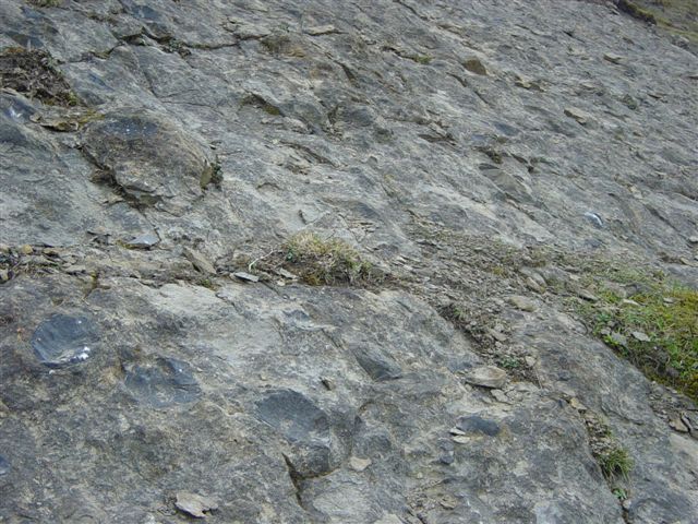
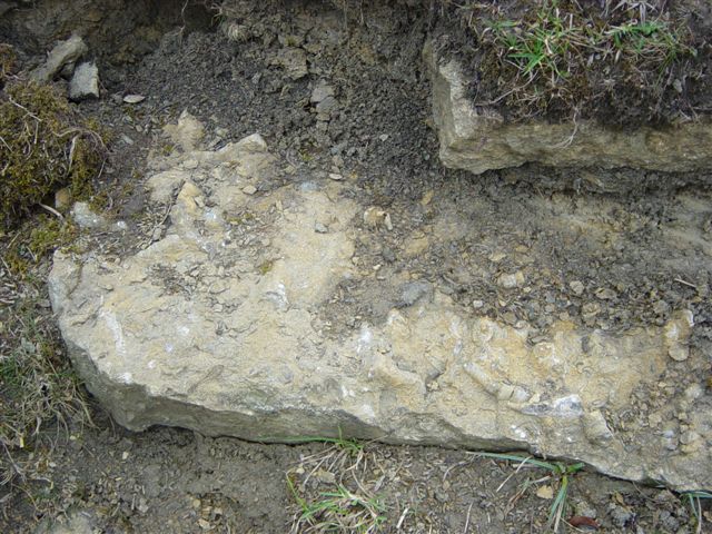
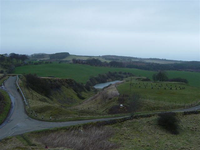
At the former water-storage reservoir of Petershill, one
kilometer to the north-east of Bathgate, limestones rich in
brachiopods, crinoids and corals are well displayed. East
Kirkton quarry is close by, and is famed for the discovery made
there by Stan Woods of possibly the world's oldest known fossil reptile, Westlothiana Lizziae,
now on display in the National Museum of Scotland. Further
north, igneous intrusions underlie The Knock and Cairnpapple
Hill. The latter, the highest summit in West Lothian, was
not visited, but is an important pre-historic site and an
impressive viewpoint on a good day. Another good viewpoint is to
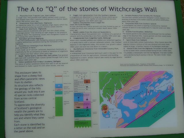
be found a little further north at Witchcraigs, where lettered
stones have been set into a sheltering wall, and represent local
geology.
Much of the geology around the Bathgate-Linlithgow area is
obscured by extensive sheets of glacial boulder clay. |