| 28th April - 1st May 2007 | ||||||||||||||||||
| EIGG | ||||||||||||||||||
Tour: Geowalks |
||||||||||||||||||
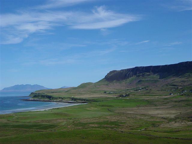
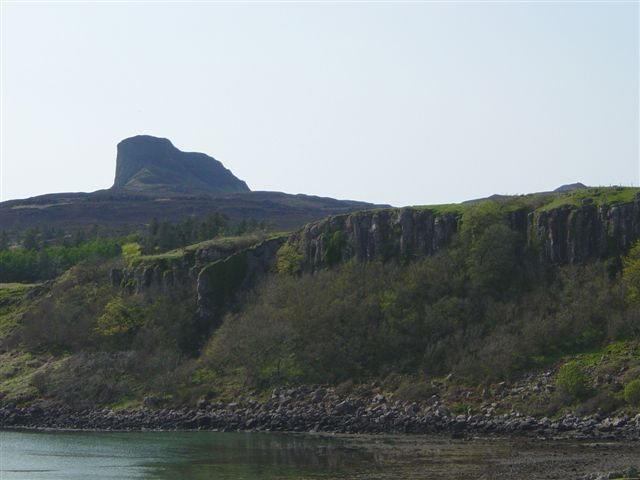
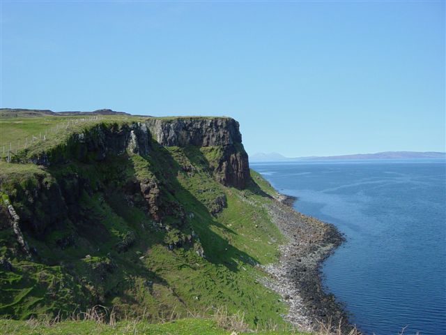
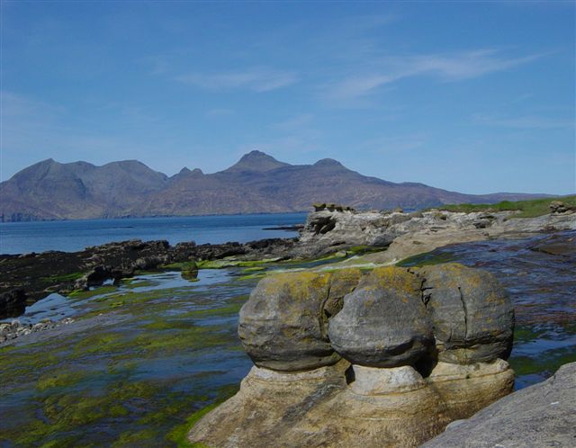
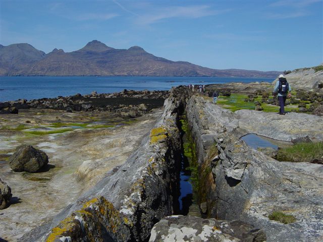
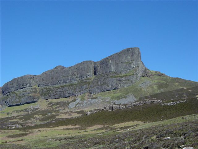
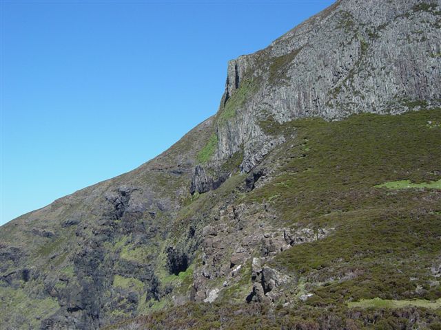
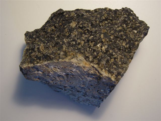
Weather: Warm and sunny throughout, with clear skies or wispy cloud. Summary of Geology: (reference: The Geology of Eigg, by John Hudson and Ann Allwright, 2003) The geology of the island of Eigg is dominated by rocks of Jurassic age, approximately 200-140 Ma,and of early Tertiary age, 63-52 Ma. The Jurassic rocks are soft sedimentary rocks, sandstones and limestones, best exposed in the north-west, around Laig Bay and in a thin strip extending down the east coast. They include the Valtos Sandstone formation, beautifully exposed at Laig Bay and famed for its concretions - these are rounded masses of calcite-cemented sandstone in a matrix of softer sandstone. Oysters, ammonites and belemnites can all be found among rocks of Jurassic age, but most remarkably, the bones of marine reptile plesiosaurs have been found in blocks of red limestones around the north and east coast. Traces of Cretaceous rocks remain only in patches above the Jurassic in the Laig Bay area. Rocks of Tertiary age are entirely igneous in origin on Eigg. They include dykes and sills, and 500 metres of lava flows, the latter dominating the surface geology of the island. Good examples can be found of vertical tubes in rubbly lower layers, of columnar jointing associated with the central parts of flows (always perpendicular to cooling surfaces), of zeolite-filled gas vesicles in both top and bottom layers of flows, and of red bole weathering on flow tops. The prominent topographical feature known as the Sgurr of Eigg deserves special mention: The Sgurr of Eigg The origin of this feature has been the subject of controversy for many years and a summary is presented here of the generally accepted theory of its formation. 60 million years ago A thick sequence of very fluid, basaltic lava flows spread over the island of Eigg, solidified, and was cut by vertical dykes. Deep valleys were eroded into the lava plateau, the principal axis extending from the present location of the Sgurr in the east to Bidein Boidheach on the west coast. Boulders of the basalt and even of Torridonian Sandstone (no longer exposed locally) were rounded by river transport and transported into the valley floor, later to be solidified as conglomerates. Traces of the abundant vegetation of the times also reached the valley bottom, and were preserved there, including the famous "Eigg Pine". This period of erosion, followed by deposition seems to have lasted for about 2 million years. 58 million years ago Volcanic activity recommenced, depositing first ash and pumice on top of the river deposits, and later thick, viscous, high SiO2 lava flows, which consolidated as pitchstones with columns at first angled perpendicularly to the sloping valley floor and later trending more vertically. There then followed a long period of sustained erosion, culminating in the glaciation of the last 2 million years, and continuing today. The relatively soft basalts of the valley sides were eroded down, while the hard pitchstone was much more resistant to erosion - the former valley was thus inverted to form a long, sinuous, steep-sided ridge! (Rb-Sr age dating has now revealed a 52 Ma age for the pitchstone) Alternative Theories Some experts have proposed that the Sgurr pitchstone is a sill, but the presence of the conglomerate under the pitchstone is particularly hard to explain under such a theory. There are, however, sill-like layers, composed of light coloured felsite within the pitchstone itself - they have yet to be explained in detail.
|
||||||||||||||||||
|
||||||||||||||||||