2nd September 2007 |
||||||||||||||||||
| SOUTH QUEENSFERRY | ||||||||||||||||||
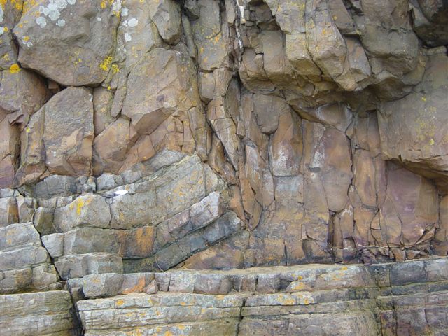
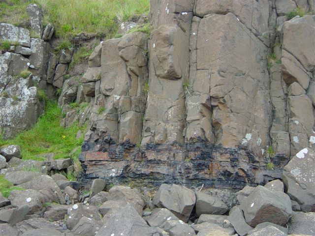
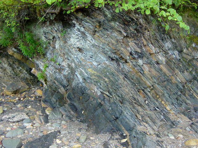
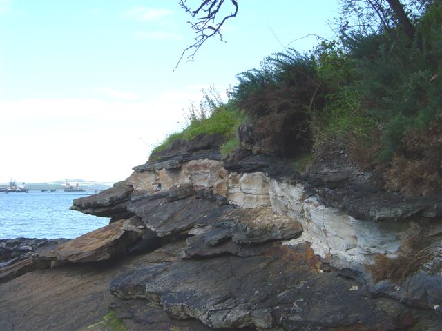
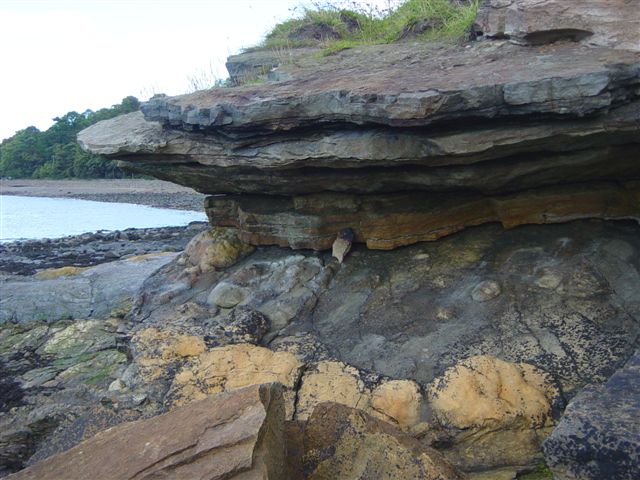
Tour: O.U.G.S. (West Scotland). Leader: Andrew McLeish. Weather: Cool and cloudy at first, but improving. Access: We followed the coastal path from the Forth Rail Bridge to Hound Point, about 2.5 km to the east. By starting the walk there, we were able to walk back up the succession along the shore. Summary: Sedimentary rocks along the South Queensferry shore are of Carboniferous age, and more specifically belong to the Lower and Upper Oil Shale Groups of the Calciferous Sandstone series. The succession is almost entirely non-marine, and consists of sandstones, limestones, cementstones and oil shales which were laid down in deltaic or lagoonal environments. At Hound Point can be seen the lowest of three sills of doleritic origin which cut the sediments within the South Queensferry section (illustrated). The middle sill has been altered to white trap, as shown, while the upper sill cuts sediments close to the Forth Rail Bridge and is unremarkable. Another sill, this time of teschenite (similar to dolerite, but containing white analcite) outcrops between Peatdraught Bay and Whitehouse Bay. It may be 100 metres thick, although that assessment may be unreliable due to undulations within the sill. It is remarkable for its differentiation, with large crystals of black titanaugite (up to 15cm x 1cm) in central zones. Mudstones above the sill in Whitehouse Bay have been metamorphosed by heat contact with the sill, thereby becoming spotted. Sedimentary rocks within the South Queensferry section include cementstones at Long Rib, said to contain bivalves, brachiopods and other fossils. Further up the section, we found shales with plant remains and coprolites. Some of the shales are organic rich - these oil shales may be identified by the fact that a thin sliver stripped along the surface will curl up, as was illustrated to us during the field trip. These oil shales were heat treated locally during the 19th century to produce paraffins, and reddened spent pebbles from this process are common along the shoreline. Finally, almost under the rail bridge, we examined the Dunnet Sandstone, which contains numerous plant remains, mostly hollow casts, large and small, of stigmaria and other rootlets. Incidentally, the rail bridge itself has supports built of resistant Aberdeen granite, with clearly visible crystals of quartz, feldspar and white mica and occasional xenolithic inclusions. |
||||||||||||||||||
|
||||||||||||||||||