26th August 2007 |
|
| CAMPSIE GLEN |
| Access: The field trip starts at the car park/bus terminus at Clachan of Campsie. |
Tour: Geowalks
Weather: a fine, sunny day
Summary:
The high ground that forms the Campsie Fells is built of a thick sequence of Carboniferous lava flows, the Campsie Lavas. In the lower ground to the south of the Campsies, these lavas have been downfaulted by the Campsie Fault, which forms the often prominent scarp found along the south slopes of the Fells. The complete sequence of lavas does, in fact, lie below the lower ground in the south, though its top is rarely exposed locally.
On ascending Campsie Glen from the car park, the fault is crossed over about 200 yards to the north, though glacial and river erosion have obliterated any evidence for it in this vicinity. In the higher ground to the north, Lower Carboniferous sedimentary rocks belonging to the Cementstone Group and lying stratigraphically below the lavas are exposed in Campsie Glen, to be followed upwards in the Glen and onto the Fells, by the complete sequence of lavas.
Many of the lavas in the Campsies are of Markle basalt, a distinctive type having large elongated white phenocrysts in a fine-grained groundmass. They may be examined conveniently in the old quarry just above the car park on the Crow Road (excursion guide: locality 6).
|
|
|
| |
 |
Excursion Guide: locality 1.
The dyke seen here on the left crosses the stream bed, and is displaced there by a fault. The dyke has been carbonated, its original ferromagnesian minerals having been converted to carbonates, producing the white colour. Sediments belong to the Cementstone Group, and consist of black shales and orange-white, often nodular, dolomites. Unusually, the stream water here flows over the softer, black shales, which must have been recently exposed. |
| |
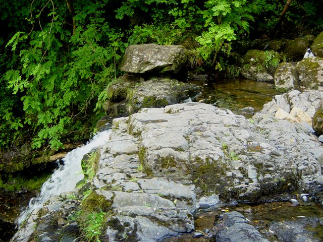 |
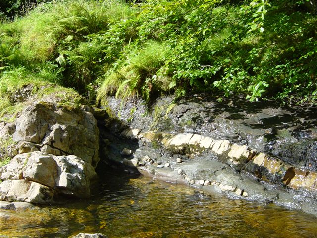
Excursion Guide: locality 2.
This dolerite complex crosses the stream bed to form a prominent waterfall. The dyke cuts the Cementstone Group sediments.
|
| |
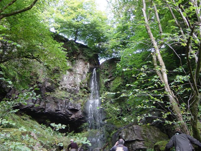 |
Excursion Guide: locality 3.
Spout o'Craiglee. Here, a tributary burn runs over a high cliff formed by the lowest three flows of the Campsie Lavas. Red bole weathering between some of the flows indicates rapid soil formation between eruptions, in the hot and humid climatic conditions of the time. |
| |
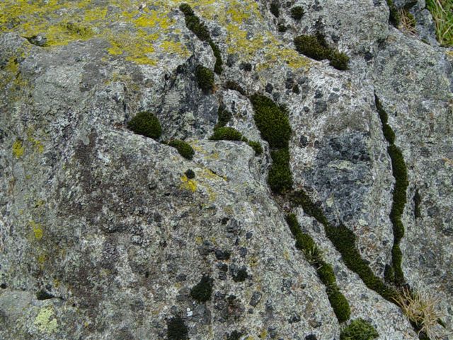 |
Excursion Guide: locality 9.
The Lennoxtown Essexite, as exposed close to the Crow Road. This distinctive porphyritic igneous rock contains large (0.5 cm) black phenocrysts of pyroxene (augite), which stand out best against weathered surfaces of the white plagioclase matrix. Boulders plucked from this area have been found as erratics over to the east, and have helped confirm ice movement in the final stage of the Ice Age as being from west to east.
|
| |
TOP |
NEXT FIELD TRIP > |
|
|